The Bertie, Trehafod
Introduction
The photograph on this page of The Bertie, Trehafod by Jaggery as part of the Geograph project.
The Geograph project started in 2005 with the aim of publishing, organising and preserving representative images for every square kilometre of Great Britain, Ireland and the Isle of Man.

There are currently over 7.5m images from over 14,400 individuals and you can help contribute to the project by visiting https://www.geograph.org.uk
The Bertie, Trehafod
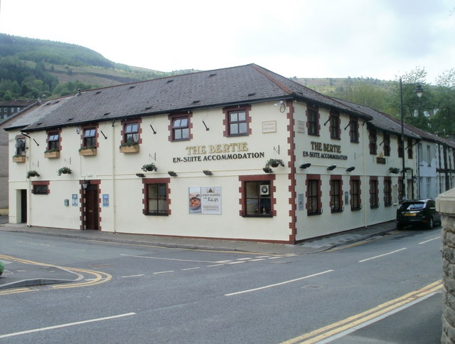
Image: © Jaggery Taken: 6 May 2011
Pub, hotel and restaurant located on the corner of Phillips Terrace and Cadwgan Terrace, on the west bank of the River Rhondda. Bertie was the name of a shaft sunk in 1880 at the nearby Lewis Merthyr Colliery, now Rhondda Heritage Park. It was named after one of the sons of the colliery owner (William Thomas Lewis, Lord Merthyr).
Images are licensed for reuse under creativecommons.org/licenses/by-sa/2.0
Image Location
Latitude
51.609654
Longitude
-3.384859