Boundary markers at Colwick (2)
Introduction
The photograph on this page of Boundary markers at Colwick (2) by Alan Murray-Rust as part of the Geograph project.
The Geograph project started in 2005 with the aim of publishing, organising and preserving representative images for every square kilometre of Great Britain, Ireland and the Isle of Man.

There are currently over 7.5m images from over 14,400 individuals and you can help contribute to the project by visiting https://www.geograph.org.uk
Boundary markers at Colwick (2)
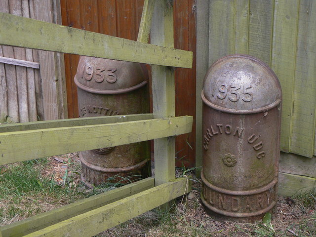
Image: © Alan Murray-Rust Taken: 24 May 2011
This pair of boundary markers share the traditional City of Nottingham shape. It seems clear that the right hand one, marked Carlton UDC, has come from the same source, but I have not seen any other similar ones relating to Carlton. The provision of two markers is in itself quite unusual; the normal procedure would be to create a shared marked with both authorities' names. Also of interest is that the two markers have different dates. The markers would have been installed here as a result of an expansion of the City of Nottingham boundaries in 1933. The Nottingham marker is seen unobstructed in this image http://www.geograph.org.uk/photo/2427669 .
Images are licensed for reuse under creativecommons.org/licenses/by-sa/2.0
Image Location
Latitude
52.953457
Longitude
-1.092001