Friar Lane, Nottingham (Domesday 1986 comparison)
Introduction
The photograph on this page of Friar Lane, Nottingham (Domesday 1986 comparison) by Alan Murray-Rust as part of the Geograph project.
The Geograph project started in 2005 with the aim of publishing, organising and preserving representative images for every square kilometre of Great Britain, Ireland and the Isle of Man.

There are currently over 7.5m images from over 14,400 individuals and you can help contribute to the project by visiting https://www.geograph.org.uk
Friar Lane, Nottingham (Domesday 1986 comparison)
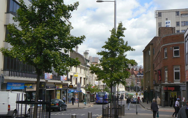
Image: © Alan Murray-Rust Taken: 24 May 2011
Picture taken specifically for comparison with Domesday Reloaded http://www.bbc.co.uk/history/domesday/dblock/GB-456000-339000/picture/1 . Not quite replicated for day of week, time of day or time of year (note the Christmas decorations). The most noticeable changes are the restructuring of the roadway (now one-way and reduced in width, with trees planted in the pavement area) and the refurbished office block on the left. The windows have been replaced and an additional storey added.
Images are licensed for reuse under creativecommons.org/licenses/by-sa/2.0
Image Location
Latitude
52.952192
Longitude
-1.152011