Former Barbour's Mill, Hilden (6)
Introduction
The photograph on this page of Former Barbour's Mill, Hilden (6) by Albert Bridge as part of the Geograph project.
The Geograph project started in 2005 with the aim of publishing, organising and preserving representative images for every square kilometre of Great Britain, Ireland and the Isle of Man.

There are currently over 7.5m images from over 14,400 individuals and you can help contribute to the project by visiting https://www.geograph.org.uk
Former Barbour's Mill, Hilden (6)
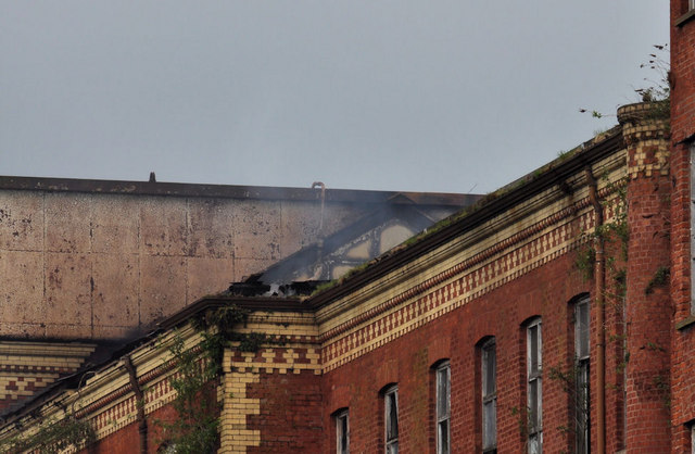
Image: © Albert Bridge Taken: 22 May 2011
See Image I walked along the towpath, from Lambeg, arriving at Hilden just after 09.20. At a distance of, perhaps, a ¼ mile there was a strong smell of burning/smoke which I thought was inevitable since the extensive fire was still less than a day ago. I did notice, however, that there was smoke coming from the top of the building (middle of the photograph). From thus angle, on the towpath, the damage was not particularly apparent. Image gives a better idea of the damage.
Images are licensed for reuse under creativecommons.org/licenses/by-sa/2.0
Image Location
Latitude
54.519436
Longitude
-6.022207