Leeds Road
Introduction
The photograph on this page of Leeds Road by Robert Wade as part of the Geograph project.
The Geograph project started in 2005 with the aim of publishing, organising and preserving representative images for every square kilometre of Great Britain, Ireland and the Isle of Man.

There are currently over 7.5m images from over 14,400 individuals and you can help contribute to the project by visiting https://www.geograph.org.uk
Leeds Road
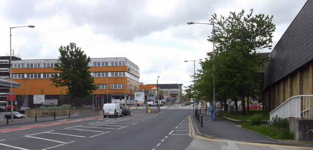
Image: © Robert Wade Taken: 19 May 2011
Looking towards the town centre, the theatre has been demolished (where the tree is) giving a view of what was the Co-Op, the building on the right is the abandoned Tesco and mid photo work continues to de-pedestrianise the Manchester Road area
Images are licensed for reuse under creativecommons.org/licenses/by-sa/2.0
Image Location


Leaflet Map data © OpenStreetMap
Latitude
53.837433
Longitude
-2.212708