Askerton Castle
Introduction
The photograph on this page of Askerton Castle by Oliver Dixon as part of the Geograph project.
The Geograph project started in 2005 with the aim of publishing, organising and preserving representative images for every square kilometre of Great Britain, Ireland and the Isle of Man.

There are currently over 7.5m images from over 14,400 individuals and you can help contribute to the project by visiting https://www.geograph.org.uk
Askerton Castle
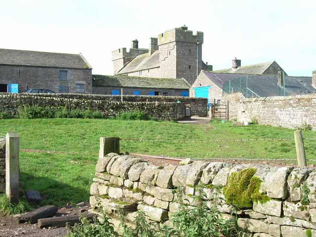
Image: © Oliver Dixon Taken: 15 Sep 2006
This truly impressive example of a fortified farmhouse dates back to the days of the Border Reivers with the oldest parts of the building probably dating from the 14th century. http://www.askertoncastle.co.uk/AskertonCastleHistory.htm
Images are licensed for reuse under creativecommons.org/licenses/by-sa/2.0
Image Location
Latitude
55.015311
Longitude
-2.703694