St.Edmund's church, Town End, Sprotbrough
Introduction
The photograph on this page of St.Edmund's church, Town End, Sprotbrough by Richard Croft as part of the Geograph project.
The Geograph project started in 2005 with the aim of publishing, organising and preserving representative images for every square kilometre of Great Britain, Ireland and the Isle of Man.

There are currently over 7.5m images from over 14,400 individuals and you can help contribute to the project by visiting https://www.geograph.org.uk
St.Edmund's church, Town End, Sprotbrough
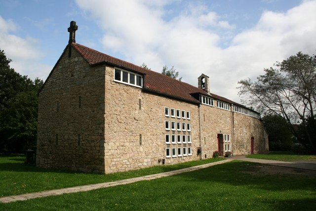
Image: © Richard Croft Taken: 5 Sep 2006
This part of Sprotbrough is known as Town End, developed on farmland during the industrial growth of the 1920s, St.Edmund's church on Anchorage Lane was formed by converting an old barn. It stands close to the site of the medieval Ancres Chapel and the stone used for the barn may have been robbed from the chapel.
Images are licensed for reuse under creativecommons.org/licenses/by-sa/2.0
Image Location
Latitude
53.528763
Longitude
-1.153666