Portland roofscape, seen from the Heights
Introduction
The photograph on this page of Portland roofscape, seen from the Heights by Stefan Czapski as part of the Geograph project.
The Geograph project started in 2005 with the aim of publishing, organising and preserving representative images for every square kilometre of Great Britain, Ireland and the Isle of Man.

There are currently over 7.5m images from over 14,400 individuals and you can help contribute to the project by visiting https://www.geograph.org.uk
Portland roofscape, seen from the Heights
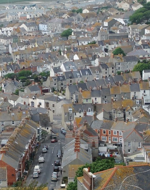
Image: © Stefan Czapski Taken: 4 May 2011
This area of the island - its most extensive urban area - can appear quite colourful, whether seen from street level http://www.geograph.org.uk/photo/1276410 or from above. Yellow lichen on the rooftops plays its part, and even on this island of quarries there's room for a street or two of redbrick houses.
Images are licensed for reuse under creativecommons.org/licenses/by-sa/2.0
Image Location
Latitude
50.558968
Longitude
-2.443798