Information Board, City Barge, Kew
Introduction
The photograph on this page of Information Board, City Barge, Kew by Christine Matthews as part of the Geograph project.
The Geograph project started in 2005 with the aim of publishing, organising and preserving representative images for every square kilometre of Great Britain, Ireland and the Isle of Man.

There are currently over 7.5m images from over 14,400 individuals and you can help contribute to the project by visiting https://www.geograph.org.uk
Information Board, City Barge, Kew
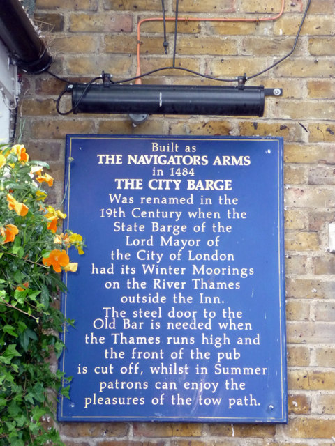
Image: © Christine Matthews Taken: 11 May 2011
Originally built as the Navigators Inn, this public house was re-named The City Barge in the 19th century when the state barge of the Lord Mayor of the City of London was moored outside the inn in the winter. The metal door of the Old Bar is needed when the Thames floods.
Images are licensed for reuse under creativecommons.org/licenses/by-sa/2.0
Image Location
Latitude
51.485623
Longitude
-0.279476