Manchester Metrolink construction by Pollard Street, Manchester
Introduction
The photograph on this page of Manchester Metrolink construction by Pollard Street, Manchester by P L Chadwick as part of the Geograph project.
The Geograph project started in 2005 with the aim of publishing, organising and preserving representative images for every square kilometre of Great Britain, Ireland and the Isle of Man.

There are currently over 7.5m images from over 14,400 individuals and you can help contribute to the project by visiting https://www.geograph.org.uk
Manchester Metrolink construction by Pollard Street, Manchester
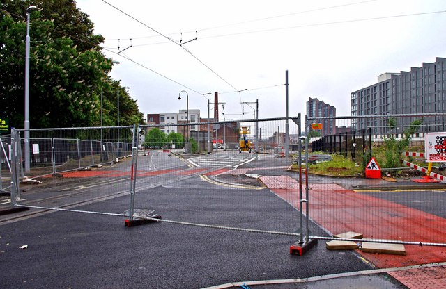
Image: © P L Chadwick Taken: 7 May 2011
On the left is Pollard Street, and to the right is Carruthers Street. Ahead the tramway has been constructed on private right-of-way, as part of its route to Piccadilly Railway Station and Manchester's city centre. As the rails and overhead power lines have now been installed here, it is likely that testing of trams on this section will be carried out in the next few months. The view a year earlier, in May 2010:- Image
Images are licensed for reuse under creativecommons.org/licenses/by-sa/2.0
Image Location
Latitude
53.482123
Longitude
-2.217103