Vestiges of the Great Central Railway
Introduction
The photograph on this page of Vestiges of the Great Central Railway by John Sutton as part of the Geograph project.
The Geograph project started in 2005 with the aim of publishing, organising and preserving representative images for every square kilometre of Great Britain, Ireland and the Isle of Man.

There are currently over 7.5m images from over 14,400 individuals and you can help contribute to the project by visiting https://www.geograph.org.uk
Vestiges of the Great Central Railway
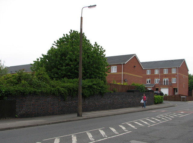
Image: © John Sutton Taken: 6 May 2011
The blue-brick wall was once the parapet of a bridge which carried Kersall Drive over a number of tracks immediately south of Bulwell Common South Junction. The Great Central Railway main line from Marylebone to Sheffield, via Leicester Central and Nottingham Victoria was the last main line to be built (1898) and the first to close (1966 as a through route and 1968 here to goods traffic). Since closure the railway land has been redeveloped as housing. See Image] and Image] for other angles.
Images are licensed for reuse under creativecommons.org/licenses/by-sa/2.0
Image Location
Latitude
52.995626
Longitude
-1.179768