Clarendon Park - the site of Carrington railway station
Introduction
The photograph on this page of Clarendon Park - the site of Carrington railway station by John Sutton as part of the Geograph project.
The Geograph project started in 2005 with the aim of publishing, organising and preserving representative images for every square kilometre of Great Britain, Ireland and the Isle of Man.

There are currently over 7.5m images from over 14,400 individuals and you can help contribute to the project by visiting https://www.geograph.org.uk
Clarendon Park - the site of Carrington railway station
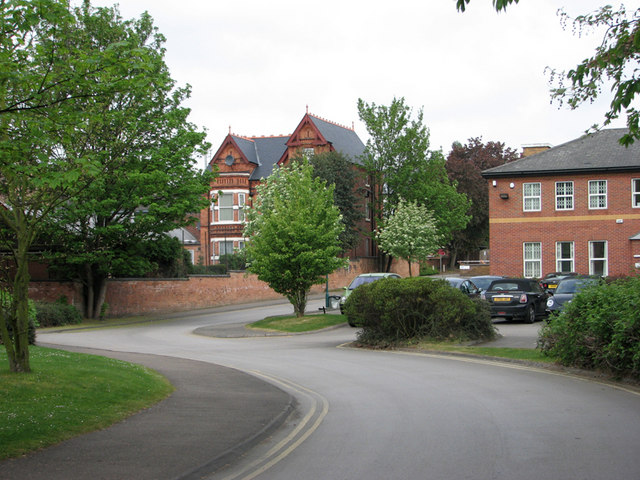
Image: © John Sutton Taken: 27 Apr 2011
This business park is built on the filled-in site of Carrington Station, which stood between Mansfield Road and Sherwood Rise Tunnels on the Great Central line from Nottingham Victoria. The platforms were about 25ft below the present ground level. The station was only open to passengers from 1899-1928 (trams were a more convenient way to and from the city), but its derelict remains were a good place for truanting schoolboys to go trainspotting until the line closed in 1968. The south portal of Sherwood Rise Tunnel was directly under where the cars are parked; the red-brick wall to their left, belonging to the Victorian house on Clumber Avenue, was the boundary of the railway land. For an idea of Carrington Station nearly 50 years before, see Image
Images are licensed for reuse under creativecommons.org/licenses/by-sa/2.0
Image Location
Latitude
52.96948
Longitude
-1.155991