North-eastern slopes of Meikle Caldon Hill
Introduction
The photograph on this page of North-eastern slopes of Meikle Caldon Hill by Lairich Rig as part of the Geograph project.
The Geograph project started in 2005 with the aim of publishing, organising and preserving representative images for every square kilometre of Great Britain, Ireland and the Isle of Man.

There are currently over 7.5m images from over 14,400 individuals and you can help contribute to the project by visiting https://www.geograph.org.uk
North-eastern slopes of Meikle Caldon Hill
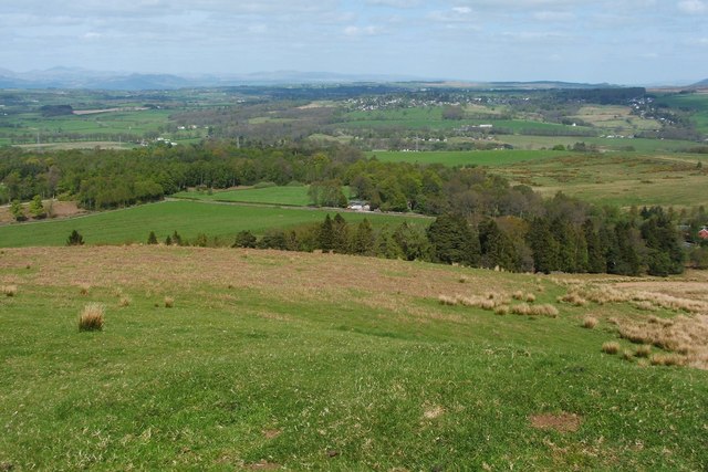
Image: © Lairich Rig Taken: 22 Apr 2011
The photograph was taken from the summit of the hill. A farm track from High Finnich enters the image about half-way up the left-hand edge; see Image for a view along that track. In the present view, it joins the main road (the Stockiemuir Road), which passes through the centre of the image, where a white building is visible. That building is Killearn Lodge. Compare Image
Images are licensed for reuse under creativecommons.org/licenses/by-sa/2.0
Image Location
Latitude
56.017353
Longitude
-4.417566