Possible Bronze Age cairn, Meikle Caldon Hill
Introduction
The photograph on this page of Possible Bronze Age cairn, Meikle Caldon Hill by Lairich Rig as part of the Geograph project.
The Geograph project started in 2005 with the aim of publishing, organising and preserving representative images for every square kilometre of Great Britain, Ireland and the Isle of Man.

There are currently over 7.5m images from over 14,400 individuals and you can help contribute to the project by visiting https://www.geograph.org.uk
Possible Bronze Age cairn, Meikle Caldon Hill
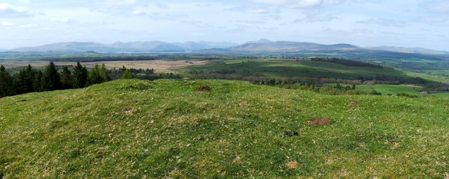
Image: © Lairich Rig Taken: 22 Apr 2011
This photograph shows the summit area of Meikle Caldon Hill. Visible in the foreground is a large mound, with a flattened centre. The OS map notes this ancient cairn, now overgrown with turf, as an antiquity (see the end-note of this item for more information). However, note also my comment, in the end-note, about a flagstaff. In the distant background, Loch Lomond is on the left. Ben Lomond (Image) is the highest skyline peak, a little right of centre. Meikle Caldon Hill appears as "Kaldon Hill" on the Pont/Blaeu map of the Lennox (that map was based on surveys carried out in the 1580s-90s).
Images are licensed for reuse under creativecommons.org/licenses/by-sa/2.0
Image Location
Latitude
56.016979
Longitude
-4.418345