Ruskin Park House
Introduction
The photograph on this page of Ruskin Park House by Derek Harper as part of the Geograph project.
The Geograph project started in 2005 with the aim of publishing, organising and preserving representative images for every square kilometre of Great Britain, Ireland and the Isle of Man.

There are currently over 7.5m images from over 14,400 individuals and you can help contribute to the project by visiting https://www.geograph.org.uk
Ruskin Park House
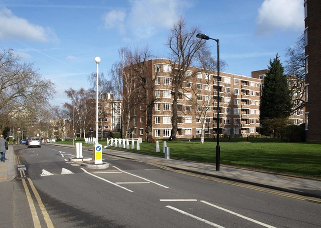
Image: © Derek Harper Taken: 11 Mar 2011
The development, on Champion Hill, is in three blocks; block A, on the right, is the central and was completed first in 1951. Beyond is block C. You can just see the dark corner of block B on the extreme right http://www.ruskinparkhouse.org.uk/estate-information.php .
Images are licensed for reuse under creativecommons.org/licenses/by-sa/2.0
Image Location
Latitude
51.46577
Longitude
-0.089174