Crossroads at the centre of Denbury
Introduction
The photograph on this page of Crossroads at the centre of Denbury by David Smith as part of the Geograph project.
The Geograph project started in 2005 with the aim of publishing, organising and preserving representative images for every square kilometre of Great Britain, Ireland and the Isle of Man.

There are currently over 7.5m images from over 14,400 individuals and you can help contribute to the project by visiting https://www.geograph.org.uk
Crossroads at the centre of Denbury
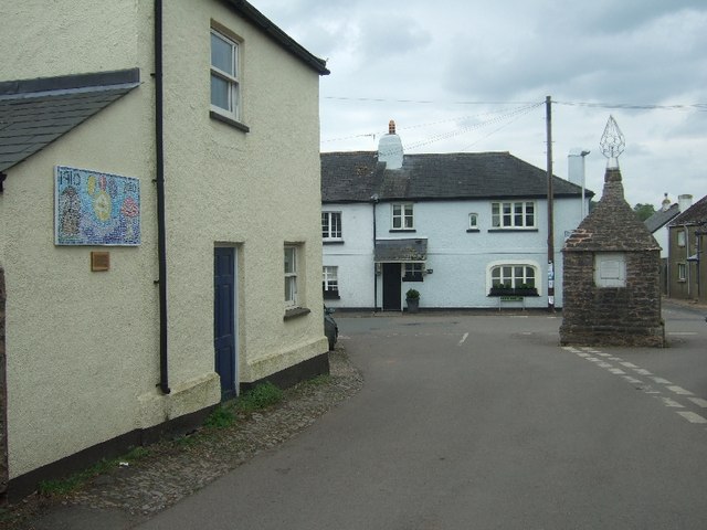
Image: © David Smith Taken: 3 May 2011
On the wall at the left is a mosaic made by the local Brownies to mark the centenary of Girl Guides in 2010. In the centre of the street is the Denbury Cistern. It supplied water to the village from a spring on Denbury Down until the 20th century.
Images are licensed for reuse under creativecommons.org/licenses/by-sa/2.0
Image Location
Latitude
50.507857
Longitude
-3.660656