The edge of Moreton Hall estate
Introduction
The photograph on this page of The edge of Moreton Hall estate by John Goldsmith as part of the Geograph project.
The Geograph project started in 2005 with the aim of publishing, organising and preserving representative images for every square kilometre of Great Britain, Ireland and the Isle of Man.

There are currently over 7.5m images from over 14,400 individuals and you can help contribute to the project by visiting https://www.geograph.org.uk
The edge of Moreton Hall estate
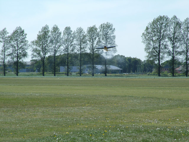
Image: © John Goldsmith Taken: 1 May 2011
A very large model of a Yak aerobatic aircraft makes an emergency landing, with smoke on, in front of Rougham airfield's famous row of trees. Behind that we see the Audi dealership and a few houses, neatly symbolising the mixed industrial and housing nature of the Moreton Hall estate. The event was Bury Model Flying Club's "Flying At Its Best" model show.
Images are licensed for reuse under creativecommons.org/licenses/by-sa/2.0
Image Location
Latitude
52.24362
Longitude
0.76279