Fields of Gold
Introduction
The photograph on this page of Fields of Gold by Andy Farrington as part of the Geograph project.
The Geograph project started in 2005 with the aim of publishing, organising and preserving representative images for every square kilometre of Great Britain, Ireland and the Isle of Man.

There are currently over 7.5m images from over 14,400 individuals and you can help contribute to the project by visiting https://www.geograph.org.uk
Fields of Gold
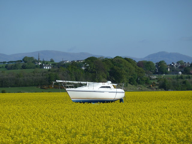
Image: © Andy Farrington Taken: 3 May 2011
I drive past Baldoon Airfield most days and always keep an eye open for photo opportunities not least of all because I know this boat is "tied up" on a trailer near to the main runway of the airfield. Last year a crop of barley was grown and I took a couple of similar shots, Image] and Image], this year it's rapeseed. The view is across the airfield towards Wigtown. On the left is The Wigtown Martyrs Monument which stands on Windy Hill http://www.undiscoveredscotland.co.uk/wigtown/martyrs/index.html. On the horizon are the Galloway Hills with the Cairnsmore of Fleet far right of the picture. Not a cloud in the sky and bright sunshine on the day I visited.
Images are licensed for reuse under creativecommons.org/licenses/by-sa/2.0
Image Location
Latitude
54.846224
Longitude
-4.446226