The approach to Sherwood Rise Tunnel
Introduction
The photograph on this page of The approach to Sherwood Rise Tunnel by John Sutton as part of the Geograph project.
The Geograph project started in 2005 with the aim of publishing, organising and preserving representative images for every square kilometre of Great Britain, Ireland and the Isle of Man.

There are currently over 7.5m images from over 14,400 individuals and you can help contribute to the project by visiting https://www.geograph.org.uk
The approach to Sherwood Rise Tunnel
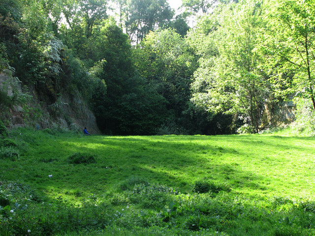
Image: © John Sutton Taken: 28 Apr 2011
The Great Central Railway main line from London Marylebone to Sheffield via Leicester and Nottingham was the last trunk route to be completed (1899) and the first to close (1967). North of Nottingham much of its route has disappeared - embankments flattened, cuttings filled, viaducts demolished - and it is hard to follow. After passing through a deep cutting in the sandstone south of New Basford station, southbound trains entered the 665-yard Sherwood Rise Tunnel (ahead). The cutting has been filled in: the railway track was getting on for twenty feet below the current ground level. The sheer side of the cutting through the Lenton sandstone is clearly shown on the left of the picture. See Image] and Image After leaving Sherwood Rise Tunnel, steam-engine crews had only a 100-yard respite at Carrington before the line entered the sulphurous 1,189-yard Mansfield Road Tunnel, which took trains to Nottingham Victoria station.
Images are licensed for reuse under creativecommons.org/licenses/by-sa/2.0
Image Location
Latitude
52.974456
Longitude
-1.160511