Seven Kings: Great Eastern Main Line
Introduction
The photograph on this page of Seven Kings: Great Eastern Main Line by Nigel Cox as part of the Geograph project.
The Geograph project started in 2005 with the aim of publishing, organising and preserving representative images for every square kilometre of Great Britain, Ireland and the Isle of Man.

There are currently over 7.5m images from over 14,400 individuals and you can help contribute to the project by visiting https://www.geograph.org.uk
Seven Kings: Great Eastern Main Line
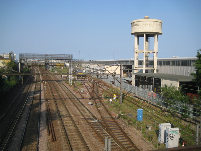
Image: © Nigel Cox Taken: 25 Apr 2011
This is the view of the Great Eastern Main Line, built through here in 1839, looking towards Liverpool Street from the Aldborough Road South bridge. The 1864 Ordnance Survey map calls this the Cauliflower Bridge. On the right is the eastern end of the large Ilford Depot and Maintenance Works, which includes the water tower. The Seven Kings Curve of the Great Eastern Railway's Woodford and Ilford Branch, opened in 1903, diverted from the main line and curved off to the right more or less under where the water tower is now. The curve was lifted when the Ilford Depot was expanded in the late 1950s.
Images are licensed for reuse under creativecommons.org/licenses/by-sa/2.0
Image Location
Latitude
51.56333
Longitude
0.090648