Fort Southwick
Introduction
The photograph on this page of Fort Southwick by Martyn Pattison as part of the Geograph project.
The Geograph project started in 2005 with the aim of publishing, organising and preserving representative images for every square kilometre of Great Britain, Ireland and the Isle of Man.

There are currently over 7.5m images from over 14,400 individuals and you can help contribute to the project by visiting https://www.geograph.org.uk
Fort Southwick
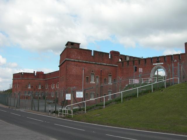
Image: © Martyn Pattison Taken: 10 Apr 2005
Another of the "Palmerston Forts" built to protect Portsmouth from land attack. In more recent times Fort Southwick was part of the control centre for the D-Day invasions. There were (and still are in some cases) a network of underground tunnels and war rooms under Fort Southwick, linking many of the other forts and military establishments in the area.
Images are licensed for reuse under creativecommons.org/licenses/by-sa/2.0
Image Location


Leaflet Map data © OpenStreetMap
Latitude
50.8574
Longitude
-1.108862