NW edge of Cwmfelinfach
Introduction
The photograph on this page of NW edge of Cwmfelinfach by Jaggery as part of the Geograph project.
The Geograph project started in 2005 with the aim of publishing, organising and preserving representative images for every square kilometre of Great Britain, Ireland and the Isle of Man.

There are currently over 7.5m images from over 14,400 individuals and you can help contribute to the project by visiting https://www.geograph.org.uk
NW edge of Cwmfelinfach
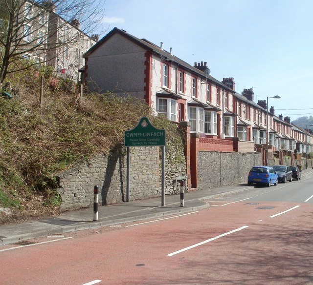
Image: © Jaggery Taken: 7 Apr 2011
Maindee Road (B4251) from Ynysddu reaches the border of Cwmfelinfach, a village in the Sirhowy valley. A literal translation of the Welsh name is "valley of the little mill". The row of 15 houses is named Pioneer Terrace.
Images are licensed for reuse under creativecommons.org/licenses/by-sa/2.0
Image Location
Latitude
51.620869
Longitude
-3.181523