Blackboy Hill
Introduction
The photograph on this page of Blackboy Hill by Rosalind Mitchell as part of the Geograph project.
The Geograph project started in 2005 with the aim of publishing, organising and preserving representative images for every square kilometre of Great Britain, Ireland and the Isle of Man.

There are currently over 7.5m images from over 14,400 individuals and you can help contribute to the project by visiting https://www.geograph.org.uk
Blackboy Hill
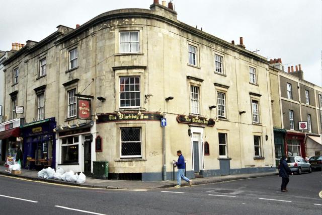
Image: © Rosalind Mitchell Taken: 2 Dec 2002
The Black Boy Inn at the corner of Whiteladies Road and Lower Redland Road. The terracing of the buildings at left shows how the road is starting to climb steeply to the Downs, giving the top of Whiteladies Road the unofficial name of Blackboy Hill.
Images are licensed for reuse under creativecommons.org/licenses/by-sa/2.0
Image Location


Leaflet Map data © OpenStreetMap
Latitude
51.468761
Longitude
-2.613237