Giggleswick School Dining Hall
Introduction
The photograph on this page of Giggleswick School Dining Hall by William Bartlett as part of the Geograph project.
The Geograph project started in 2005 with the aim of publishing, organising and preserving representative images for every square kilometre of Great Britain, Ireland and the Isle of Man.

There are currently over 7.5m images from over 14,400 individuals and you can help contribute to the project by visiting https://www.geograph.org.uk
Giggleswick School Dining Hall
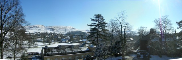
Image: © William Bartlett Taken: 10 Feb 2006
The long building lower centre is the new dining hall and the building to the right is Holywell Toft the Headmaster's house. St Peter's Church and the village are seen beyond and in the distance the hills above Settle and the Ribble Valley
Images are licensed for reuse under creativecommons.org/licenses/by-sa/2.0
Image Location


Leaflet Map data © OpenStreetMap
Latitude
54.072473
Longitude
-2.293374