Barkingside: Pert Cottages
Introduction
The photograph on this page of Barkingside: Pert Cottages by Nigel Cox as part of the Geograph project.
The Geograph project started in 2005 with the aim of publishing, organising and preserving representative images for every square kilometre of Great Britain, Ireland and the Isle of Man.

There are currently over 7.5m images from over 14,400 individuals and you can help contribute to the project by visiting https://www.geograph.org.uk
Barkingside: Pert Cottages
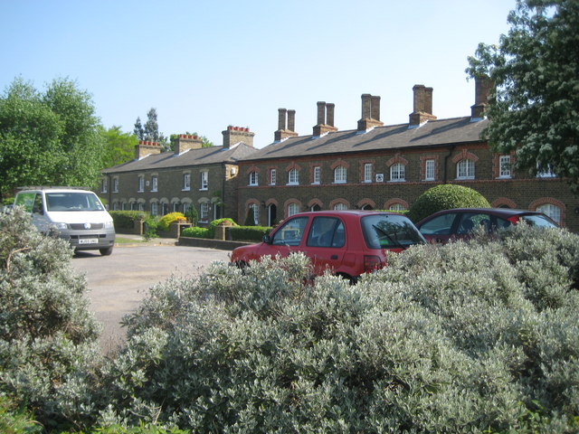
Image: © Nigel Cox Taken: 25 Apr 2011
Two separate terraced blocks make up these former artisans' cottages, which were built in 1860 on the north side of Tanners Lane when Barking Side, as it was then known, was just a rural community. Several of these are Grade II Listed Buildings. Although contemporary with each other the two blocks are completely different with the tall angled chimneys of the block on the right giving a much older Tudor appearance. The old Ordnance Survey map of 1864 shows the cottages and also some other similar structures immediately to the west along Tanners Lane and shown as Vaughan and Clifton Cottages. Of these not a trace can be seen today. The old map also shows how the front gardens of Pert Cottages stretched right to left in the photograph across the present day Sandringham Gardens, which was only built during the inter-war residential development of the area.
Images are licensed for reuse under creativecommons.org/licenses/by-sa/2.0
Image Location
Latitude
51.588456
Longitude
0.083572