Murthly Crossroads
Introduction
The photograph on this page of Murthly Crossroads by Paul McLennan as part of the Geograph project.
The Geograph project started in 2005 with the aim of publishing, organising and preserving representative images for every square kilometre of Great Britain, Ireland and the Isle of Man.

There are currently over 7.5m images from over 14,400 individuals and you can help contribute to the project by visiting https://www.geograph.org.uk
Murthly Crossroads
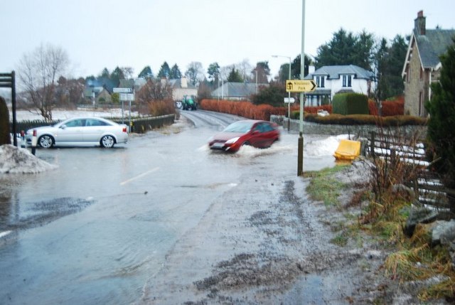
Image: © Paul McLennan Taken: 15 Jan 2011
Snowmelt on 15 January 2011 caused the deepest flooding at the crossroads for many years.
Images are licensed for reuse under creativecommons.org/licenses/by-sa/2.0
Image Location
Latitude
56.528055
Longitude
-3.466638