The Larches
Introduction
The photograph on this page of The Larches by spanishliz as part of the Geograph project.
The Geograph project started in 2005 with the aim of publishing, organising and preserving representative images for every square kilometre of Great Britain, Ireland and the Isle of Man.

There are currently over 7.5m images from over 14,400 individuals and you can help contribute to the project by visiting https://www.geograph.org.uk
The Larches
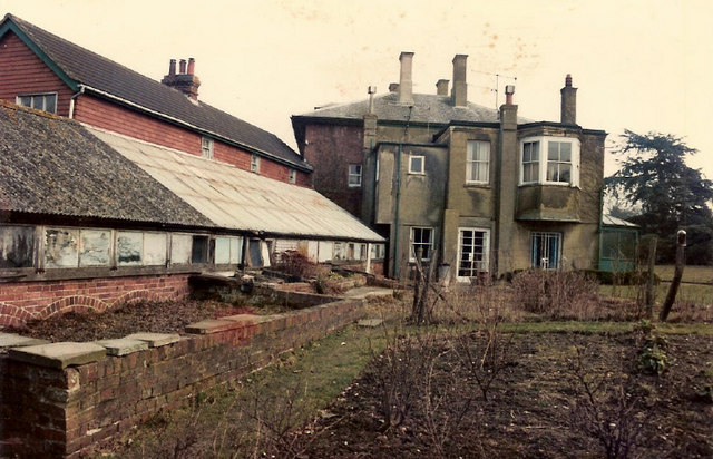
Image: © spanishliz Taken: Unknown
Side view of main house of The Larches, showing greenhouse and part of former servants' quarters. Taken from just inside main Sandawes Hill gate.
Images are licensed for reuse under creativecommons.org/licenses/by-sa/2.0
Image Location
Latitude
51.13754
Longitude
0.006884