Barn near Crackpot
Introduction
The photograph on this page of Barn near Crackpot by Gordon Hatton as part of the Geograph project.
The Geograph project started in 2005 with the aim of publishing, organising and preserving representative images for every square kilometre of Great Britain, Ireland and the Isle of Man.

There are currently over 7.5m images from over 14,400 individuals and you can help contribute to the project by visiting https://www.geograph.org.uk
Barn near Crackpot
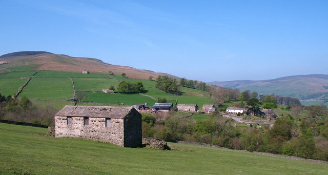
Image: © Gordon Hatton Taken: 20 Apr 2011
This typical Dales field barn appears to be in reasonable condition, but a close look reveals missing roof flags. If this isn't repaired the barn will slowly become a wreck. Hamlet of Crackpot in the background.
Images are licensed for reuse under creativecommons.org/licenses/by-sa/2.0
Image Location
Latitude
54.363654
Longitude
-2.039056