Arkwright Walk and St Saviour's Church
Introduction
The photograph on this page of Arkwright Walk and St Saviour's Church by John Sutton as part of the Geograph project.
The Geograph project started in 2005 with the aim of publishing, organising and preserving representative images for every square kilometre of Great Britain, Ireland and the Isle of Man.

There are currently over 7.5m images from over 14,400 individuals and you can help contribute to the project by visiting https://www.geograph.org.uk
Arkwright Walk and St Saviour's Church
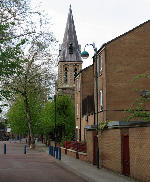
Image: © John Sutton Taken: 16 Apr 2011
The Victorian houses and shops of The Meadows district were replaced by the houses shown here. The rectilinear Victorian street plan has gone almost completely. This pedestrian street was Arkwright Street, once lined with shops and the main bus and trolleybus route from the city centre to Trent Bridge. St Saviour's dates from 1863. My grandparents were married there in 1905.
Images are licensed for reuse under creativecommons.org/licenses/by-sa/2.0
Image Location
Latitude
52.941694
Longitude
-1.142247