Stoneford Barn
Introduction
The photograph on this page of Stoneford Barn by Michael Dibb as part of the Geograph project.
The Geograph project started in 2005 with the aim of publishing, organising and preserving representative images for every square kilometre of Great Britain, Ireland and the Isle of Man.

There are currently over 7.5m images from over 14,400 individuals and you can help contribute to the project by visiting https://www.geograph.org.uk
Stoneford Barn
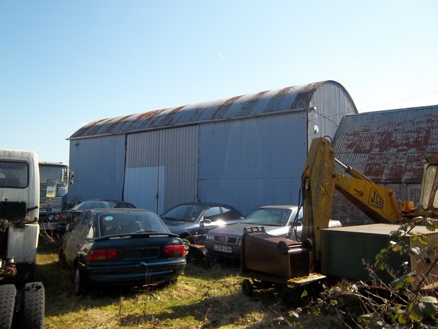
Image: © Michael Dibb Taken: 19 Mar 2011
Doubtless once used for agricultural produce, the barn is now surrounded by elderly vehicles some of which have obviously not moved for some considerable time.
Images are licensed for reuse under creativecommons.org/licenses/by-sa/2.0
Image Location
Latitude
52.081583
Longitude
-1.859281