Theobalds Road
Introduction
The photograph on this page of Theobalds Road by Simon Carey as part of the Geograph project.
The Geograph project started in 2005 with the aim of publishing, organising and preserving representative images for every square kilometre of Great Britain, Ireland and the Isle of Man.

There are currently over 7.5m images from over 14,400 individuals and you can help contribute to the project by visiting https://www.geograph.org.uk
Theobalds Road
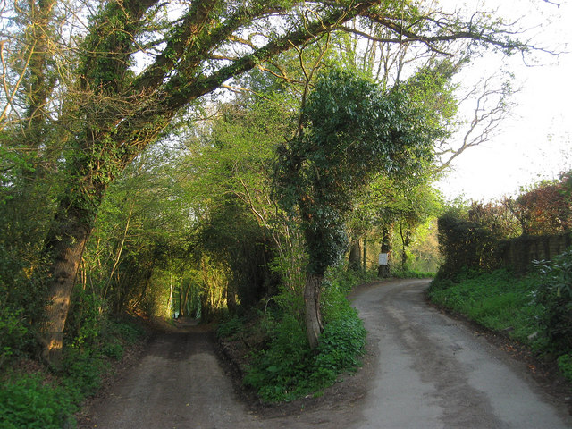
Image: © Simon Carey Taken: 10 Apr 2011
Some older maps have the road continuing to the left other newer maps to the right. The hollow way to the left is the clue to which is the older route, now a public bridleway linking World's End to Lunces Common. The newer route to the right is a private road providing access to a number of individual houses and farms.
Images are licensed for reuse under creativecommons.org/licenses/by-sa/2.0
Image Location
Latitude
50.971942
Longitude
-0.109799