Bolt benchmark, St Stephen's
Introduction
The photograph on this page of Bolt benchmark, St Stephen's by Neil Owen as part of the Geograph project.
The Geograph project started in 2005 with the aim of publishing, organising and preserving representative images for every square kilometre of Great Britain, Ireland and the Isle of Man.

There are currently over 7.5m images from over 14,400 individuals and you can help contribute to the project by visiting https://www.geograph.org.uk
Bolt benchmark, St Stephen's
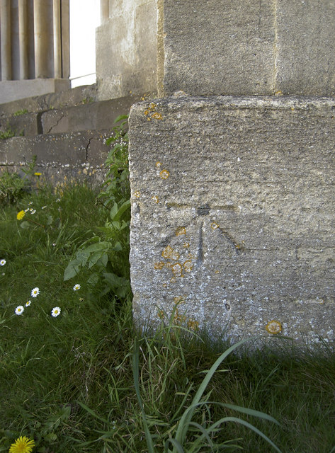
Image: © Neil Owen Taken: 8 Apr 2011
A nice if somewhat weathered benchmark on St Stephen's dating from 1849. It is a branch from the main Gloucester to London levelling line. See http://www.bench-marks.org.uk/bm35448 for the Database and more information. Also see Image] for a wider view of this impressive parish church.
Images are licensed for reuse under creativecommons.org/licenses/by-sa/2.0
Image Location
Latitude
51.392563
Longitude
-2.363717