Escot church
Introduction
The photograph on this page of Escot church by Derek Harper as part of the Geograph project.
The Geograph project started in 2005 with the aim of publishing, organising and preserving representative images for every square kilometre of Great Britain, Ireland and the Isle of Man.

There are currently over 7.5m images from over 14,400 individuals and you can help contribute to the project by visiting https://www.geograph.org.uk
Escot church
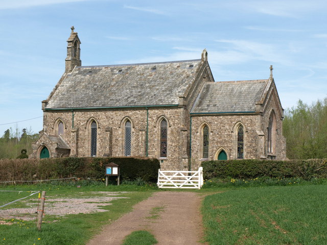
Image: © Derek Harper Taken: 6 Apr 2011
A closer view of the church of St Philip and St James shown in Image, from Ottery St Mary Footpath 6, which skirts the churchyard to the right, whereas Ottery St Mary Footpath 13 branches off through the gate to cross the River Tale nearby. The church was consecrated in 1840 http://www.britishlistedbuildings.co.uk/en-397518-church-of-st-philip-and-st-james-ottery- .
Images are licensed for reuse under creativecommons.org/licenses/by-sa/2.0
Image Location


Leaflet Map data © OpenStreetMap
Latitude
50.769072
Longitude
-3.2955