Woodneuk aqueduct and Red Burn
Introduction
The photograph on this page of Woodneuk aqueduct and Red Burn by Robert Murray as part of the Geograph project.
The Geograph project started in 2005 with the aim of publishing, organising and preserving representative images for every square kilometre of Great Britain, Ireland and the Isle of Man.

There are currently over 7.5m images from over 14,400 individuals and you can help contribute to the project by visiting https://www.geograph.org.uk
Woodneuk aqueduct and Red Burn
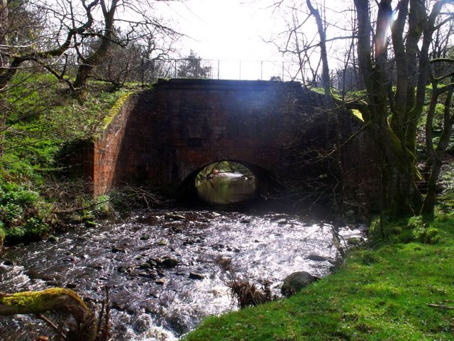
Image: © Robert Murray Taken: 9 Apr 2011
Everything you see in this photo is man made - including the river. The aqueduct, built in 1770 carries the Forth & Clyde canal. The canal Resident Engineer, Robert Mackell, under pressure to trim costs diverted the Red Burn from its natural route which went north-west to join the Bonny Water to a directly northern course to enable a shorter span for the aqueduct over the river.
Images are licensed for reuse under creativecommons.org/licenses/by-sa/2.0
Image Location
Latitude
55.983874
Longitude
-3.948329