The Old Rectory (Chesten House) Denbury
Introduction
The photograph on this page of The Old Rectory (Chesten House) Denbury by Colin Vosper as part of the Geograph project.
The Geograph project started in 2005 with the aim of publishing, organising and preserving representative images for every square kilometre of Great Britain, Ireland and the Isle of Man.

There are currently over 7.5m images from over 14,400 individuals and you can help contribute to the project by visiting https://www.geograph.org.uk
The Old Rectory (Chesten House) Denbury
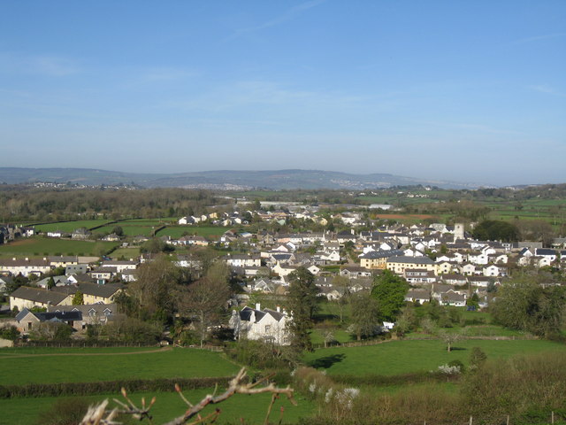
Image: © Colin Vosper Taken: 6 Apr 2011
The 'Old Rectory' is the house closest to the camera and in the centre of the picture, only half of it is within OS8168.Image The view shows Denbury village and on the skyline can be seen three Teign estuary towns. These are from left to right Kingsteignton (the town on the Teign owned by the king), Bishopsteignton and on the far right at the mouth of the estuary is Teignmouth. The view is taken from the public access track up to the Denbury iron age hill fort.
Images are licensed for reuse under creativecommons.org/licenses/by-sa/2.0
Image Location
Latitude
50.506528
Longitude
-3.665545