Oxlip
Introduction
The photograph on this page of Oxlip by Glyn Baker as part of the Geograph project.
The Geograph project started in 2005 with the aim of publishing, organising and preserving representative images for every square kilometre of Great Britain, Ireland and the Isle of Man.

There are currently over 7.5m images from over 14,400 individuals and you can help contribute to the project by visiting https://www.geograph.org.uk
Oxlip
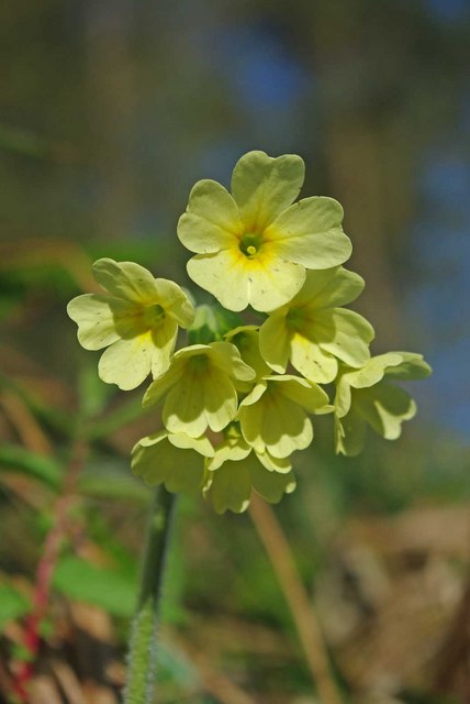
Image: © Glyn Baker Taken: 9 Apr 2011
This is an Oxlip flower, found in the U.K only in the “East Anglian Triangle” where Essex Cambridgeshire and Suffolk meet. Not only is it confined to this area it is generally only found in and around ancient woodland. There is something about the nature of the chalky boulder clay and woodland habitat that suppress the other native primulas (primrose & cowslip) and allows the Oxlip to grow. It is uncanny to follow a footpath out of an oxlip wood and after 50 yards or so cowslips are profuse and oxlips absent.
Images are licensed for reuse under creativecommons.org/licenses/by-sa/2.0
Image Location


Leaflet Map data © OpenStreetMap
Latitude
52.030456
Longitude
0.349855