St Chad's Church, Stafford
Introduction
The photograph on this page of St Chad's Church, Stafford by Bill Boaden as part of the Geograph project.
The Geograph project started in 2005 with the aim of publishing, organising and preserving representative images for every square kilometre of Great Britain, Ireland and the Isle of Man.

There are currently over 7.5m images from over 14,400 individuals and you can help contribute to the project by visiting https://www.geograph.org.uk
St Chad's Church, Stafford
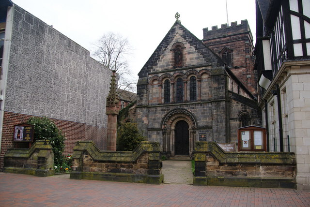
Image: © Bill Boaden Taken: 2 Apr 2011
Set back a little from the other buildings so that it could be missed. This is the oldest building in Stafford and has Norman features, together with subsequent enhancements. It is at the high end of worship.
Images are licensed for reuse under creativecommons.org/licenses/by-sa/2.0
Image Location


Leaflet Map data © OpenStreetMap
Latitude
52.806114
Longitude
-2.116553