St. Peters, Marsh Baldon
Introduction
The photograph on this page of St. Peters, Marsh Baldon by Des Blenkinsopp as part of the Geograph project.
The Geograph project started in 2005 with the aim of publishing, organising and preserving representative images for every square kilometre of Great Britain, Ireland and the Isle of Man.

There are currently over 7.5m images from over 14,400 individuals and you can help contribute to the project by visiting https://www.geograph.org.uk
St. Peters, Marsh Baldon
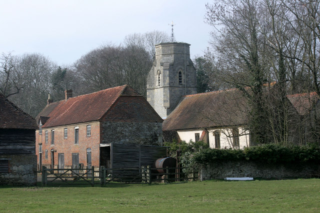
Image: © Des Blenkinsopp Taken: 15 Mar 2011
A closer view of Marsh Baldon parish church with its unusual tower, and one of the fine old buildings belonging to Baldon Manor farm. Taken from the same place as Image but without the distraction of stray farmyard animals. See http://www.westgallerychurches.com/Oxford/Marsh_Baldon/Marsh_Baldon.html which includes a little rhyme about the Baldon villages.
Images are licensed for reuse under creativecommons.org/licenses/by-sa/2.0
Image Location
Latitude
51.688128
Longitude
-1.189283