
The Woolpack Pub, Sopley
Introduction
The photograph on this page of The Woolpack Pub, Sopley by mike smith as part of the Geograph project.
The Geograph project started in 2005 with the aim of publishing, organising and preserving representative images for every square kilometre of Great Britain, Ireland and the Isle of Man.

There are currently over 7.5m images from over 14,400 individuals and you can help contribute to the project by visiting https://www.geograph.org.uk
The Woolpack Pub, Sopley
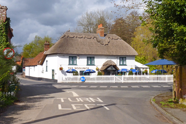
Image: © mike smith Taken: 4 Apr 2011
The Woolpack is a 17th Century building situated on the Ringwood and Christchurch road, in the village of Sopley. It was originally a private house, and became an inn in 1725. Sopley was a centre of smuggling. The smugglers boats were heaved up from the River Avon to the Woolpack, where pack horses were waiting to take the goods to the New Forest and onward to Winchester and London. Information obtained from: http://woolpackinnsopley.co.uk/hist.htm
Images are licensed for reuse under creativecommons.org/licenses/by-sa/2.0
Image Location

Latitude
50.771654
Longitude
-1.778862