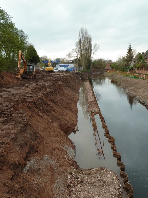
The canalisation of the River Salwarpe
Introduction
The photograph on this page of The canalisation of the River Salwarpe by Chris Allen as part of the Geograph project.
The Geograph project started in 2005 with the aim of publishing, organising and preserving representative images for every square kilometre of Great Britain, Ireland and the Isle of Man.
There are currently over 7.5m images from over 14,400 individuals and you can help contribute to the project by visiting https://www.geograph.org.uk

Image: © Chris Allen Taken: 1 Apr 2011
This section is nearly complete. In the distance there is a shallow stretch to be dredged but the foreground and middle distance of the river appears to be full depth. The towpath is being constructed in the left hand bank and contains the bywash pipeline that connects the two canals around the river section. The left bank is formed by sheet piling but the right bank is a profiled earth embankment.

