2011 : Railway to Paddington at Stoke Gifford
Introduction
The photograph on this page of 2011 : Railway to Paddington at Stoke Gifford by Maurice Pullin as part of the Geograph project.
The Geograph project started in 2005 with the aim of publishing, organising and preserving representative images for every square kilometre of Great Britain, Ireland and the Isle of Man.

There are currently over 7.5m images from over 14,400 individuals and you can help contribute to the project by visiting https://www.geograph.org.uk
2011 : Railway to Paddington at Stoke Gifford
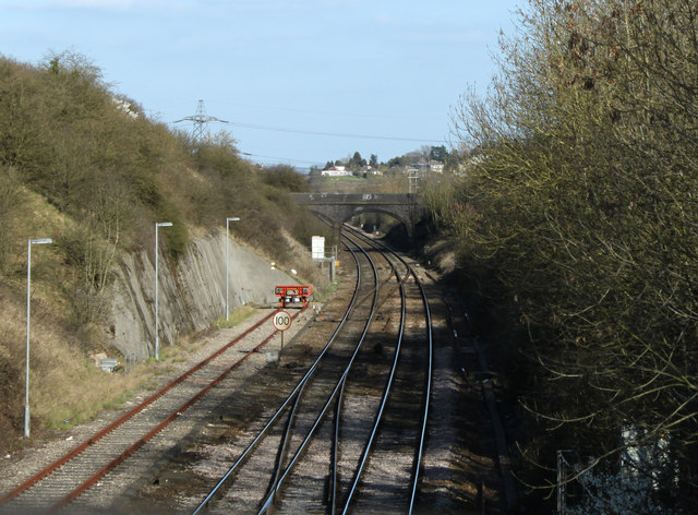
Image: © Maurice Pullin Taken: 20 Mar 2011
Heading east seen from a small bridge carrying a footpath between Stoke Gifford and Hambrook Lane. Note the unused line to the left ending in a solid looking buffer. Probably a safety line protecting the track from runaways.
Images are licensed for reuse under creativecommons.org/licenses/by-sa/2.0
Image Location
Latitude
51.514027
Longitude
-2.531704