Downshire station, Carrickfergus (1)
Introduction
The photograph on this page of Downshire station, Carrickfergus (1) by Albert Bridge as part of the Geograph project.
The Geograph project started in 2005 with the aim of publishing, organising and preserving representative images for every square kilometre of Great Britain, Ireland and the Isle of Man.

There are currently over 7.5m images from over 14,400 individuals and you can help contribute to the project by visiting https://www.geograph.org.uk
Downshire station, Carrickfergus (1)
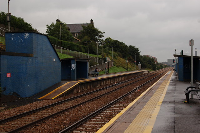
Image: © Albert Bridge Taken: 5 Sep 2006
Originally there were four stations between Carrickfergus and Whitehead. Only Downshire survives. Most of the traffic is to or from the Belfast direction. This is the view towards Whitehead and Larne.
Images are licensed for reuse under creativecommons.org/licenses/by-sa/2.0
Image Location


Leaflet Map data © OpenStreetMap
Latitude
54.721184
Longitude
-5.790429