Path to Hawthornhill Road
Introduction
The photograph on this page of Path to Hawthornhill Road by Lairich Rig as part of the Geograph project.
The Geograph project started in 2005 with the aim of publishing, organising and preserving representative images for every square kilometre of Great Britain, Ireland and the Isle of Man.

There are currently over 7.5m images from over 14,400 individuals and you can help contribute to the project by visiting https://www.geograph.org.uk
Path to Hawthornhill Road
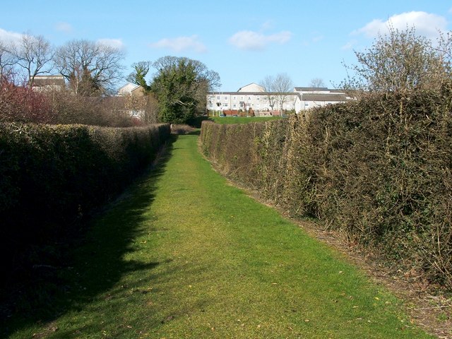
Image: © Lairich Rig Taken: 24 Mar 2011
This photograph is a view from the start of the path that can be seen, between two hedges, in Image In the present view, only the nearer part of the path (the first 30 metres or so) is in the same grid square as the photographer. This short path leads from Cardross Road to Hawthornhill Road, but it is part of a longer route, a core path, from Hawthornhill to Dalmoak. This hedge-lined path was originally a track leading from Cardross Road to Hawthornhill Farm. The farm itself is long gone, but the buildings were just to the right of the far end of this path, on the top of the grassy slope that can be seen there; see Image for the site itself. Ahead, just to the right of the far end of the path, is Image As that photo makes clear, there are a few narrow gaps between the buildings of Perray Avenue; these divide the row of houses into four sections. Without familiarity with the area, it is not at all clear where to go after ascending this path between the two hedges. However, the easiest way to continue along the core path to Dalmoak is to go through the narrow gap between the first and second sections (reckoning from the leftmost/western end) of Perray Avenue, emerging at the point shown in Image
Images are licensed for reuse under creativecommons.org/licenses/by-sa/2.0
Image Location
Latitude
55.949429
Longitude
-4.601704