Keil Mansions
Introduction
The photograph on this page of Keil Mansions by Lairich Rig as part of the Geograph project.
The Geograph project started in 2005 with the aim of publishing, organising and preserving representative images for every square kilometre of Great Britain, Ireland and the Isle of Man.

There are currently over 7.5m images from over 14,400 individuals and you can help contribute to the project by visiting https://www.geograph.org.uk
Keil Mansions
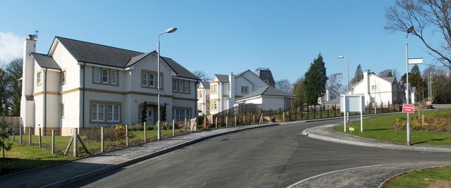
Image: © Lairich Rig Taken: 24 Mar 2011
The houses shown here are part of a recent development on what had previously been the grounds of Keil School; for the main description of the school and its surroundings, see Image The development is variously described on signs in the area; older ones say "Keil Mansions", and newer ones "The Mansions at Keil School", which seems to be the development's full name (at the time of writing). The road leading uphill in this photograph is Image, with Dixon Drive branching off to the right in the foreground. For a view of another part of the same development, located just downhill from the part shown in my photograph, see Image, which was, coincidentally, taken on the previous day.
Images are licensed for reuse under creativecommons.org/licenses/by-sa/2.0
Image Location
Latitude
55.940395
Longitude
-4.582521