The closure of The Crab Tree at Crab Tree
Introduction
The photograph on this page of The closure of The Crab Tree at Crab Tree by Dave Spicer as part of the Geograph project.
The Geograph project started in 2005 with the aim of publishing, organising and preserving representative images for every square kilometre of Great Britain, Ireland and the Isle of Man.

There are currently over 7.5m images from over 14,400 individuals and you can help contribute to the project by visiting https://www.geograph.org.uk
The closure of The Crab Tree at Crab Tree
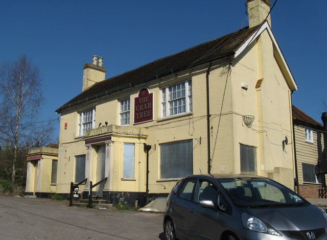
Image: © Dave Spicer Taken: 23 Mar 2011
Situated on the A281 just south of Leonardslee Gardens, which is also closed to the public. A sign above the left hand door reads 'circa 1576'. In September 2005 this photo Image was taken when it looked in its prime.
Images are licensed for reuse under creativecommons.org/licenses/by-sa/2.0
Image Location
Latitude
51.013419
Longitude
-0.261511