East Mill, Darley Abbey
Introduction
The photograph on this page of East Mill, Darley Abbey by Chris Allen as part of the Geograph project.
The Geograph project started in 2005 with the aim of publishing, organising and preserving representative images for every square kilometre of Great Britain, Ireland and the Isle of Man.

There are currently over 7.5m images from over 14,400 individuals and you can help contribute to the project by visiting https://www.geograph.org.uk
East Mill, Darley Abbey
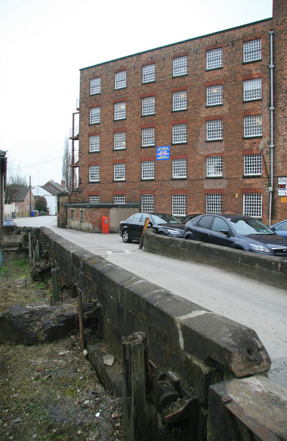
Image: © Chris Allen Taken: 26 Mar 2011
Part of the Boar's Head Mill complex at Darley Abbey. This building is c1818-21. In the left foreground are the remains of the head-race sluices for the waterpower installation in the Middle Mill that is out of field to the left. The water flowed under the road, which was on a bridge at this point. Apparently the mills' water supply was lost in 1969 and the head race is all under tarmac now.
Images are licensed for reuse under creativecommons.org/licenses/by-sa/2.0
Image Location
Latitude
52.943357
Longitude
-1.474511