Church of St.Davids at Maesmynis
Introduction
The photograph on this page of Church of St.Davids at Maesmynis by Philip Halling as part of the Geograph project.
The Geograph project started in 2005 with the aim of publishing, organising and preserving representative images for every square kilometre of Great Britain, Ireland and the Isle of Man.

There are currently over 7.5m images from over 14,400 individuals and you can help contribute to the project by visiting https://www.geograph.org.uk
Church of St.Davids at Maesmynis
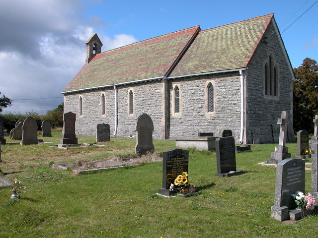
Image: © Philip Halling Taken: 29 Aug 2006
The parish church of St.Davids at Maesmynis, on the southerly ridge above Builth Wells, officially serves the community of "Duhonw", but Llanynis is the nearest notable parish. Earliest record is from 1291 in Pope Nicholas' Taxatio as 'Ecclesia de Maesmenus' and then as 'Maesmynnys' in the Valor Ecclesiasticus of 1535. Completely rebuilt in 1878. Earliest visible monument in the tidily kept churchyard is 1768 to the north of the church. There is a spectacular panoramic view of the country to the north, this is a place of real peace and beauty.
Images are licensed for reuse under creativecommons.org/licenses/by-sa/2.0
Image Location
Latitude
52.137379
Longitude
-3.421481