Clune Park Street
Introduction
The photograph on this page of Clune Park Street by Thomas Nugent as part of the Geograph project.
The Geograph project started in 2005 with the aim of publishing, organising and preserving representative images for every square kilometre of Great Britain, Ireland and the Isle of Man.

There are currently over 7.5m images from over 14,400 individuals and you can help contribute to the project by visiting https://www.geograph.org.uk
Clune Park Street
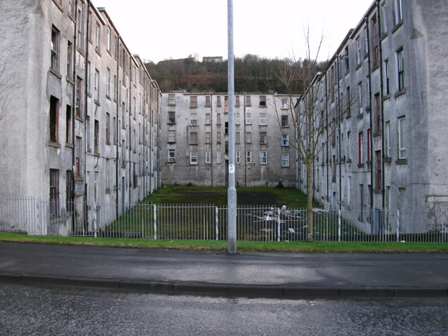
Image: © Thomas Nugent Taken: 18 Mar 2011
The rear of the flats between Clune Park Street, Glasgow Road and Wallace Street. This once desirable part of the east end of Port Glasgow has become run down in recent years.
Images are licensed for reuse under creativecommons.org/licenses/by-sa/2.0
Image Location
Latitude
55.93188
Longitude
-4.674021