Where's Henbury High?
Introduction
The photograph on this page of Where's Henbury High? by Peter Turner as part of the Geograph project.
The Geograph project started in 2005 with the aim of publishing, organising and preserving representative images for every square kilometre of Great Britain, Ireland and the Isle of Man.

There are currently over 7.5m images from over 14,400 individuals and you can help contribute to the project by visiting https://www.geograph.org.uk
Where's Henbury High?
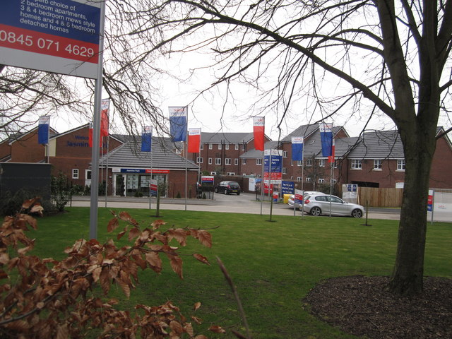
Image: © Peter Turner Taken: 26 Mar 2011
The site of Henbury High School now demolished. Jasmine Park its successor offers a variety of newbuild properties while the pupils have been relocated to Macclesfield's Learning Zone.
Images are licensed for reuse under creativecommons.org/licenses/by-sa/2.0
Image Location
Latitude
53.260547
Longitude
-2.164859