Lane End: Grouse & Ale
Introduction
The photograph on this page of Lane End: Grouse & Ale by Nigel Cox as part of the Geograph project.
The Geograph project started in 2005 with the aim of publishing, organising and preserving representative images for every square kilometre of Great Britain, Ireland and the Isle of Man.

There are currently over 7.5m images from over 14,400 individuals and you can help contribute to the project by visiting https://www.geograph.org.uk
Lane End: Grouse & Ale
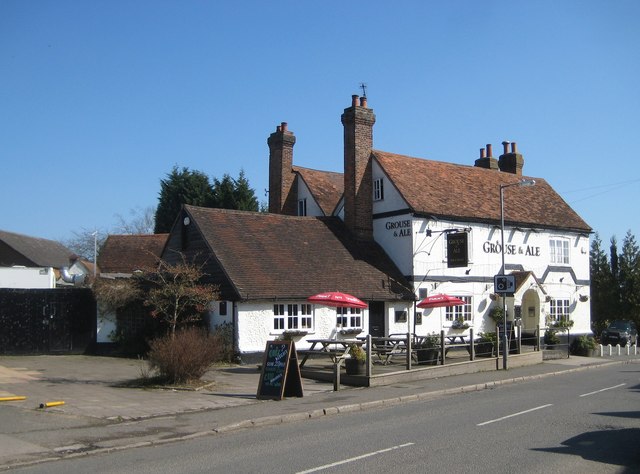
Image: © Nigel Cox Taken: 19 Mar 2011
The Grouse & Ale public house was formerly The Clayton Arms, named after a local landowning family. It is a Grade II Listed Building and the English Heritage Listed Buildings website describes it thus:- "Public house. Mid C18, altered. Colourwashed brick, colourwashed rendered plinth, old tile roof, brick chimneys to left end, and between right gables. 2 parallel ranges. 2 storeys, 2 bays. First floor band course angled upwards over porch and right window. 3-light barred wooden casements with segmental brick arches, the upper windows with C20 louvred shutters. Central blocked door in gabled brick porch with semi-circular arch. Entry in right side of rear range. Single storey extension of colourwashed flint and brick to left, with 2 bays of wooden casements and C20 door. Another flint and brick range at angle to rear."
Images are licensed for reuse under creativecommons.org/licenses/by-sa/2.0
Image Location
Latitude
51.6185
Longitude
-0.832887